
Palma de Mallorca city guide
Where to stay in Palma de Mallorca
Compare the old town, Santa Catalina, the western harbour hills and the eastern beach districts. Palma's historic walks, restaurant evenings and resort stays call for different bases.
Plan your visit
A Palma address can put you in a lane behind the cathedral, above the yacht harbour or along a beach several neighbourhoods east of the centre. The right base depends on whether you want historic walks, restaurant evenings or a repeated beach routine. These seven choices stay within Palma's urban and coastal setting rather than treating every Mallorca resort as a city neighbourhood.
Choose your base
The old town is the strongest choice for a short historic visit. Santa Catalina puts dining ahead of monuments; El Terreno combines harbour-side hotels with the Bellver hillside. Portixol and El Molinar suit seafront walks and meals without a large-resort setting. Cala Major offers a western beach beside the Miro neighbourhood. Can Pastilla is a small coastal and airport-bus base, while Playa de Palma's Les Meravelles stretch prioritises a longer resort-beach routine.
Old town: cathedral walks and historic lanes
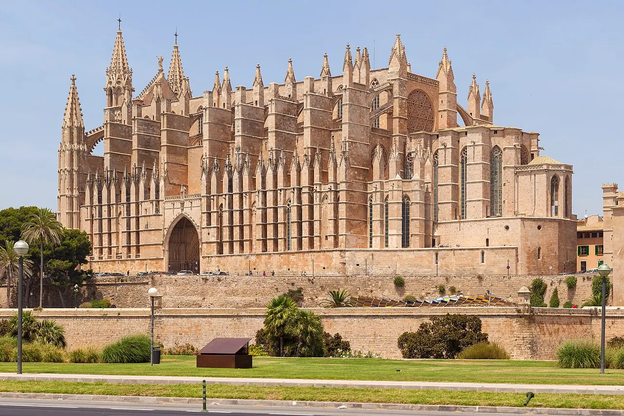
Palma's old town suits visitors who want La Seu, the Almudaina, the Arab Baths and Sant Francesc to form a walking itinerary rather than separate bus outings. Around La Llotja and Passeig del Born, the evening emphasis shifts toward restaurants and bars; the streets toward the cathedral and La Calatrava offer a different historic setting. Farther north, Placa Major, Sant Miquel and Mercat de l'Olivar add shopping and market food. Those pockets share the old town, but the street around your hotel still determines the daily atmosphere.
EMT's A1 airport bus reaches central Palma rather than every medieval lane. Placa d'Espanya provides the intermodal connection for island buses and trains; it is not an airport rail station. A cathedral-side room trades station proximity for historic surroundings, and some entrances require a final pedestrian approach. Choose Santa Catalina for a restaurant-led evening, or Portixol when a coastal walk matters more than the concentration of monuments.
Plan it well: The cathedral anchors the southern old town; hotels around Placa d'Espanya occupy its northern side.
Visit Palma: old quarterSanta Catalina: a market and restaurant-led stay
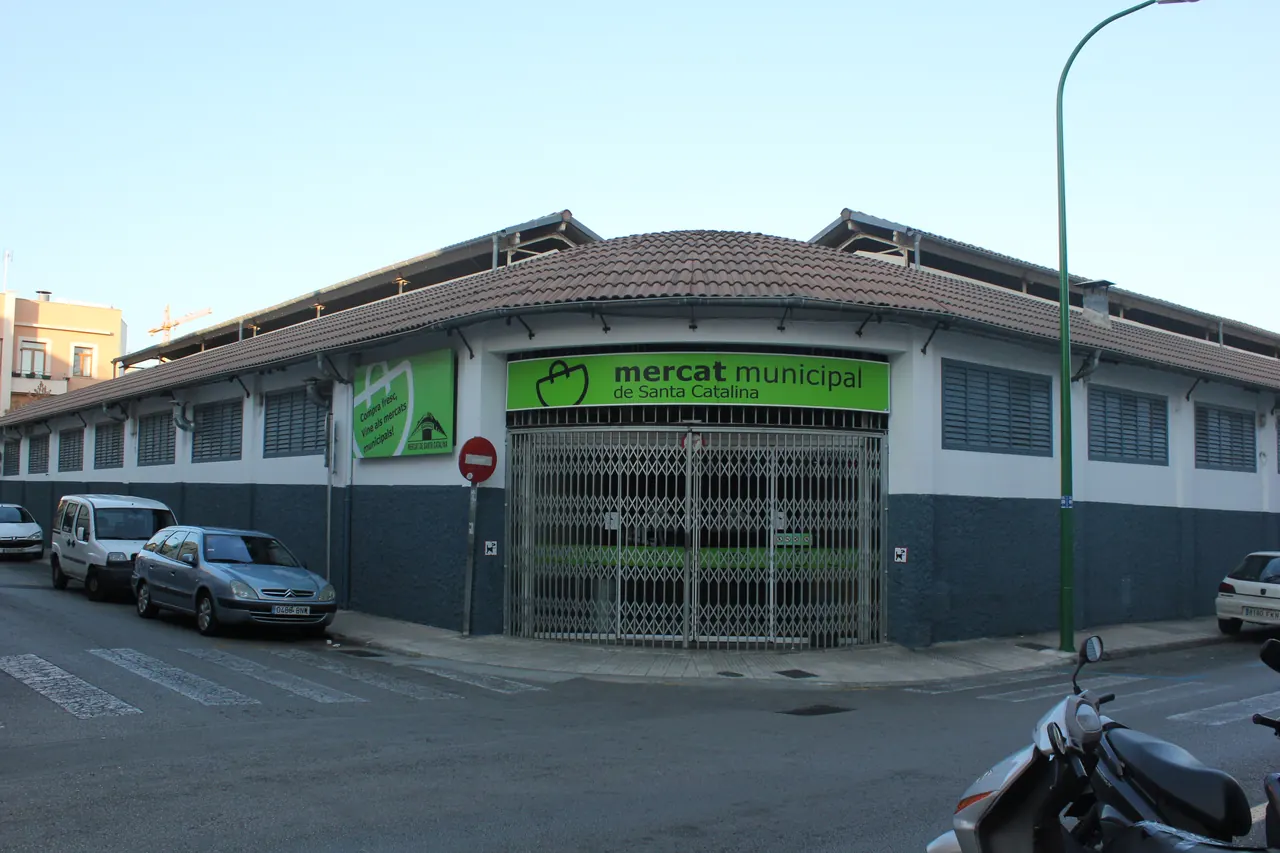
Santa Catalina is a real former fishing neighbourhood west of the old walls, not another name for the cathedral quarter. Its market gives the day an obvious starting point, with dining streets around Carrer de Sant Magi and Placa del Progres supporting a stay that revolves around meals rather than sightseeing queues. The mix of market produce, cafes and international restaurants makes it useful for a repeat Palma visit. Es Baluard is across toward the old-city walls; it should not be presented as a building inside Santa Catalina.
EMT's current map shows line 5 terminating at Placa del Progres, giving the neighbourhood a named local connection. Airport arrivals can use A1 into central Palma and complete the last leg on foot or with local transport, depending on the address. The very restaurant activity that makes the area appealing can bring late street noise. Choose the old town for monument-first days, or Cala Major for a beach that defines the stay.
Plan it well: The photo shows Santa Catalina's own market, not Mercat de l'Olivar in the old town.
Visit Palma: Santa Catalina districtEl Terreno and Bellver: harbour-side hotels with a hillside setting
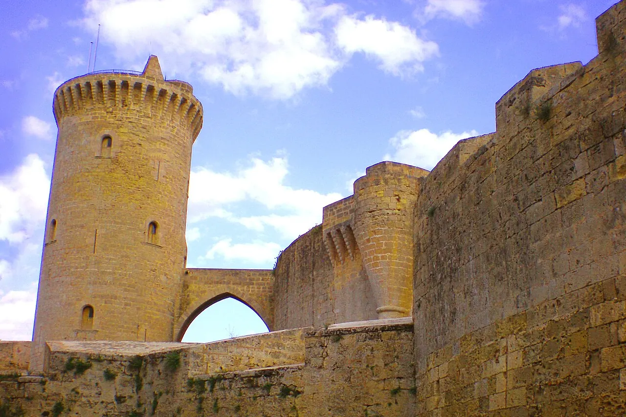
El Terreno rises behind the western Passeig Maritim, with the Quarantine Gardens and older villas giving it a distinct history beneath Bellver's wooded hill. Palma's official neighbourhood guide groups this area with Bellver and part of Son Armadans, which is a useful visitor frame without making the castle a street-centre landmark. Harbour-facing hotels along the lower corridor provide a different stay from properties on the sloping streets above. Restaurants along Joan Miro and the maritime side can serve local evenings, but this is a yacht-and-port waterfront rather than a broad sandy beach.
The current EMT map distinguishes line 1 on the port/Passeig Maritim corridor from line 4's western urban route. Use A1 from the airport into central Palma, then the appropriate local connection for the hotel. The hill and the distance back to the cathedral are the compromise, particularly with luggage or limited walking tolerance. Choose the old town for repeated central walks, or Cala Major when swimming-beach access matters more than the harbour.
Plan it well: Bellver Castle is the hilltop landmark shown in the map and photograph, not the level harbour hotel strip.
Visit Palma: neighbourhood guide, El TerrenoPortixol and El Molinar: waterfront meals and coastal walks
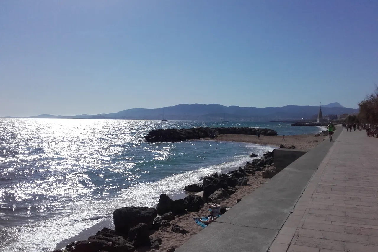
Portixol and El Molinar sit east of the historic centre, where a small harbour, low-rise waterfront streets and a continuous coastal path make the sea part of an everyday routine. Restaurants along the front serve seafood, rice dishes and other cuisines, so this base works well when an evening walk and a meal matter more than nightlife in the centre. El Molinar's shore has smaller coves and breakwaters rather than one uninterrupted resort beach. A Portixol harbour address and a hotel farther east toward Ciutat Jardi do not offer identical walks.
EMT line 35 connects the aquarium-side coastal corridor with Placa de la Reina by the cathedral; compare the inland stop and final walk with your address. Airport travel is a road journey or an A1-to-city connection followed by a local leg, not a promised doorstep airport stop. The coastline is the advantage, but repeated museum visits add travel. Choose the old town for a walking-led short break, or Playa de Palma for a larger resort-beach environment.
Plan it well: The map anchor is Es Molinar; the photograph identifies the neighbouring Portixol waterfront within this linked coastal base.
Visit Palma: Passeig des MolinarCala Major: a western beach beside the Miro neighbourhood
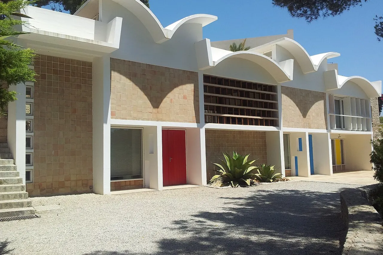
Cala Major offers an urban beach on Palma's western side, below the Joan Miro road corridor and near Sant Agusti. It is a useful compromise for visitors who want repeated sand-and-sea time without choosing the much longer eastern resort strip. The Miro Mallorca Foundation, including Sert's studio and Son Boter, lies above the beach and provides a genuinely local cultural visit. Restaurants and hotels are distributed along the road and sloping side streets, so a sea view does not establish a level, direct beach approach.
EMT's current map lists line 4 toward ses Illetes through the western coastal neighbourhoods; it supersedes old tourism-page bus numbers. An airport arrival normally needs A1 into the city and a western local connection, or a road transfer. The slope, road crossings and journey back to the old town are the trade-off. Choose Portixol for a gentler seafront-walk emphasis, or the old town when the cathedral and historic lanes should shape each day.
Plan it well: The photograph and pin show the Miro Foundation above Cala Major; they do not mark a beach entrance.
Visit Palma: Cala Major and Sant AgustiCan Pastilla: a small coastal base on the airport-bus corridor
Can Pastilla sits around its small coastal centre and Cala Estancia, at the western end of the longer Palma beach strip. Placa Pius IX and the local market give it a village-scale point of reference, while the waterfront supplies restaurants and a walking route toward Playa de Palma. This works for travellers who want to keep days near the coast but prefer that smaller harbour-and-cove setting to the Les Meravelles resort stretch. Palma Aquarium is farther along the coastal district, not beside every Can Pastilla hotel.
EMT's A2 connects the airport with the eastern coast and s'Arenal, including the Can Pastilla corridor. Line 35 offers a separate urban connection toward Placa de la Reina and the cathedral. The airport's physical proximity does not make the terminal a sensible pedestrian destination: choose the actual bus stop or road transfer. Central Palma remains a separate journey, and aircraft activity can affect the atmosphere. Choose Portixol for a more city-neighbourhood coastal stay, or the old town for repeated sightseeing on foot.
Plan it well: The pin identifies Can Pastilla, not the airport or the entire Playa de Palma coastline.
Visit Palma: Can Pastilla market and locationPlaya de Palma and Les Meravelles: a longer resort-beach routine
The Les Meravelles stretch of Playa de Palma is the choice when a long sandy shoreline, hotel facilities and promenade evenings are the main reasons to come. It lies east of Can Pastilla and is part of a much longer coastal strip, not an extension of Palma's medieval streets. Restaurants and bars cluster along the seafront and nearby resort roads, with seasonal evening activity around the market stretch on Carretera de l'Arenal. Choose the specific hotel pocket: a quieter-looking block and a busy entertainment corner can sit within the same broad beach label.
EMT's A2 gives the airport connection, while line 25 links the s'Arenal beach corridor with Placa de la Reina beside the cathedral. Consult the current operator map rather than older tourism listings of routes 15 and 21. This base trades effortless beach repetition for journeys into Palma and potentially lively nights. Choose Can Pastilla for the smaller coastal centre, or Santa Catalina when restaurants matter more than resort facilities.
Plan it well: This Wikidata district point lies by the Les Meravelles visitor corridor; it is not a shoreline or hotel entrance pin.
Visit Palma: Palma BeachArrival and coastal connections
Palma has two different airport-bus corridors. Check whether your address needs the central A1 or the eastern-coast A2 before planning any onward urban bus.
Airport routes and current city map
EMT's current network map shows A1 to Palma centre and A2 toward s'Arenal. Both are airport routes with special conditions, not general neighbourhood-hop services. The same map identifies lines 1, 4, 5, 25 and 35 used in these area comparisons.
EMT Palma: current network mapCentral A1 endpoint
The published A1 route links the airport and Passeig Mallorca-Jaume III. A cathedral-side hotel, a harbour hotel and the airport-bus endpoint are not the same location.
EMT Palma: A1 routeWalking the linked eastern coastline
The official coastal-path guide follows Portixol, El Molinar, Ciutat Jardi and onward toward Cala Estancia. It helps distinguish neighbourhood promenades from the larger Playa de Palma resort strip.
Visit Palma: coastal pathFind a Palma hotel for your kind of stay
Compare Palma de Mallorca hotels after choosing between historic-centre access, harbour-side accommodation and the eastern or western beaches. A resort along Playa de Palma can be a good beach base without being convenient for repeated old-town walks. For El Terreno or Cala Major, check the slope and actual beach or bus approach alongside the room details.
Explore Palma de Mallorca hotels