
Istanbul city guide
Where to stay in Istanbul
Compare monument-side Sultanahmet, transport-rich Sirkeci, lower and upper Beyoglu, Besiktas and two Asian waterfront bases, with hills, ferries and both airports kept distinct.
Plan your visit
In Istanbul, the bank and the slope matter as much as the neighbourhood name. Sultanahmet puts the principal monuments nearby; Sirkeci trades the square-side setting for stronger crossing options. Karakoy is below Galata and Pera, not a flat extension of them. Across the water, Kadikoy and Uskudar offer different local evenings and different journeys back to European sights. Choose around repeated outings, then distinguish Istanbul Airport from Sabiha Gokcen before planning the arrival.
Choose your base
For a short monument-led visit, choose Sultanahmet; for historic sights with Marmaray and ferry access, choose Sirkeci or Eminonu. Karakoy favours lower-waterfront cafes and tram trips; Galata and Pera favour hilltop historic streets; Taksim favours the M2 interchange and Beyoglu evenings. Besiktas favours the European Bosphorus shore. Choose Kadikoy for Asian-side food and Moda walks, or Uskudar for shoreline mosques and rail crossings.
IST rail uses M11 towards Gayrettepe and onward connections; SAW is on M4, making Kadikoy a different airport decision. A ferry-side hotel is not automatically a metro-side hotel. Check the hill or final street leg as carefully as the intercontinental crossing.
Sultanahmet: repeated walks to the principal monuments
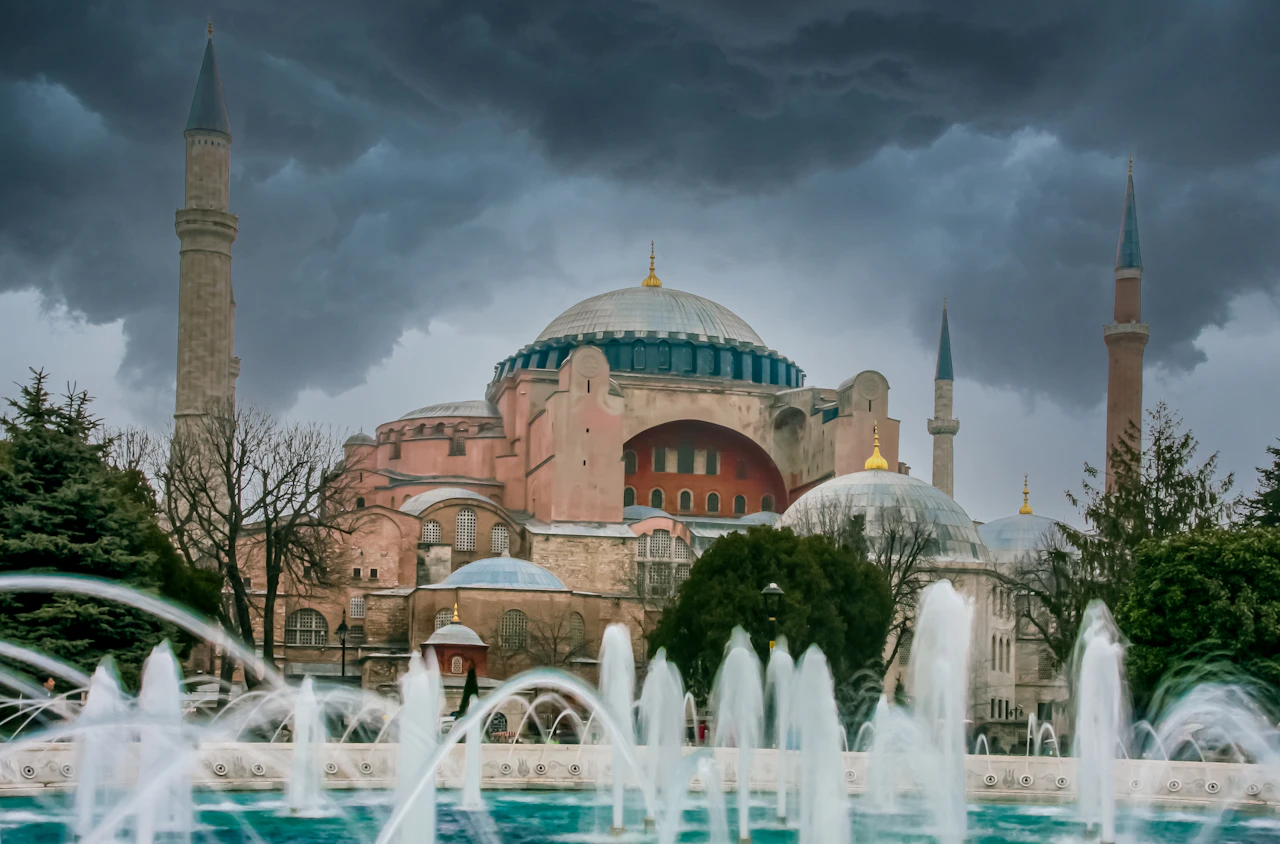
Choose Sultanahmet when Hagia Sophia, Blue Mosque, Basilica Cistern and Topkapi will shape several outings. The Hippodrome and Arasta Bazaar streets give the area an outdoor focus between visits, with cafes and food businesses around the monument cluster. This is the strongest base for repeated walks here, rather than daily crossings from the Asian side. A hotel towards the coastal edge has a different climb from one near the tram square.
Metro Istanbul T1 serves Sultanahmet and Gulhane. Havaist's resumed IST corridor uses the IETT stop opposite Catladikapi Nikah Sarayi on the coastal side, not the Sultanahmet tram square; verify the live departure and the final hotel approach. From SAW, M4 to Ayrilik Cesmesi and Marmaray to Sirkeci leaves a tram or walking leg. The tradeoff is a more monument-focused setting than Kadikoy's food streets or Beyoglu's evening scene. Choose Sirkeci for more useful crossings or Karakoy for lower-waterfront cafes when the historic sights are only one part of the trip.
Plan it well: The marker is the historic Hippodrome square, not the airport-coach stop or a hotel entrance.
GoTurkiye: Istanbul historic peninsulaSirkeci and Eminonu: historic sights with useful crossings
Stay here when the historic peninsula matters but useful crossings matter too. Gulhane Park anchors the Sirkeci end, while the Spice Bazaar, coffee and spice businesses, and waterfront fish-sandwich setting pull the day towards Eminonu. The Grand Bazaar is a separate uphill outing, not another name for the Spice Bazaar. Station-side Sirkeci and ferry-side Eminonu are different hotel pockets within this comparison.
T1 serves both Sirkeci and Eminonu; Marmaray serves Sirkeci, and Eminonu has separate ferry landings. Havaist's resumed IST route lists Sirkeci. From SAW, M4 to Ayrilik Cesmesi and Marmaray to Sirkeci gives a rail-based approach without a ferry dependency. The drawback is working waterfront and interchange activity rather than a monument-square or hilltop-street setting. A broadly labelled old-city hotel may sit uphill beyond the useful station pocket. Choose Sultanahmet for repeated walks to the main monuments, or Galata and Pera if historic lanes and Beyoglu evenings are the stay you want rather than convenient transport between them.
GoTurkiye: Eminonu neighbourhoodKarakoy: lower-waterfront cafes and tram access
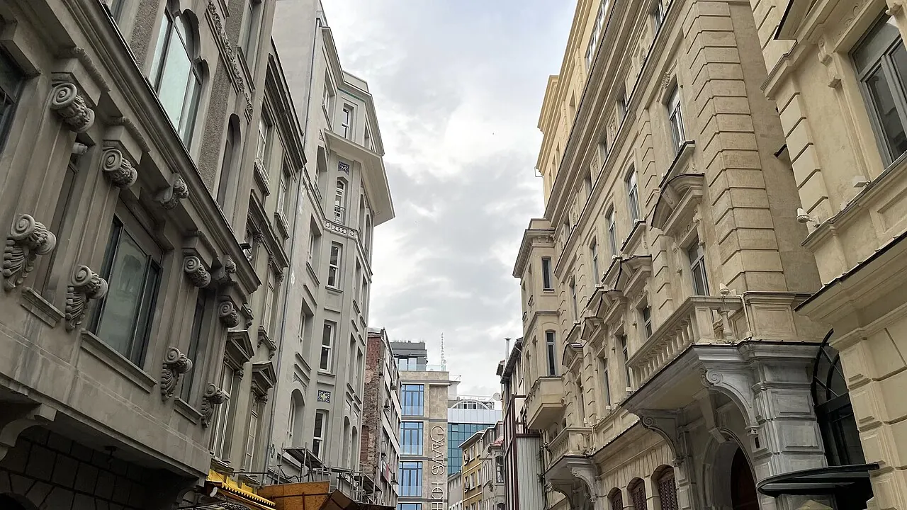
Choose Karakoy for cafe streets and the lower European waterfront, with Kilic Ali Pasa Mosque, Istanbul Modern and Galataport supplying local outings. SALT Galata sits towards the uphill edge; Galata Tower requires an ascent rather than a flat walk along the quay. A pier-side room and one nearer Tophane or Galataport give different tram walks and evening surroundings, even when both are advertised as Karakoy.
T1 serves Karakoy and Tophane, ferries serve the shore, and historic F2 Tunel links Karakoy with Beyoglu above. From IST, M11 to Gayrettepe then M2 to Sishane still leaves the descent or a planned F2 approach. From SAW, M4 to Kadikoy and the Kadikoy-Karakoy-Eminonu ferry is an option when the timetable fits. M2 is not at the ferry landing. Choose Galata and Pera if hilltop museums and lanes are your evening priority, or Sirkeci for a stronger Marmaray arrival. Karakoy works when its own cafes and waterfront culture justify the slope or crossing on other days.
GoTurkiye: Karakoy neighbourhoodGalata and Pera: historic streets above the waterfront
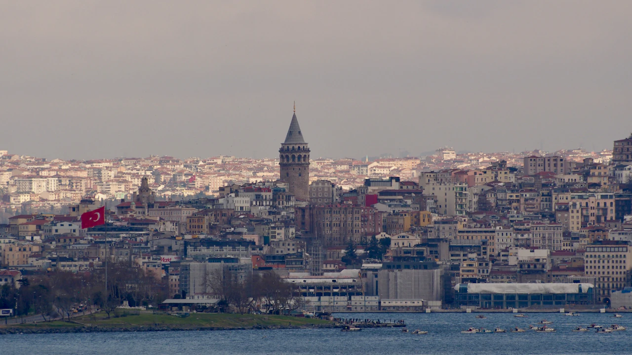
Stay above Karakoy when Galata Tower, Pera Museum, historic passages and lower Istiklal evenings are the recurring attraction. Cafes and meyhane dining give the streets a reason to linger rather than simply climb to the tower and leave. The Camondo steps are one visible connection towards the shore, but the tower-side lanes and waterfront are different elevations, not one flat hotel neighbourhood.
M2 Sishane and F2 Karakoy-Beyoglu serve this upper pocket. From IST, M11 to Gayrettepe and M2 to Sishane is a rail approach; from SAW, M4 to Ayrilik Cesmesi, Marmaray to Yenikapi and M2 to Sishane requires several changes. Steep lanes and stairs remain in the hotel leg, especially below Sishane towards the tower. Choose lower Karakoy for repeated pier and T1 trips or Taksim for a square-side M2 base. Galata and Pera earn the climb when you want the local historic streets, not when you expect immediate level access to every waterfront connection.
Plan it well: The image is a distant Galata skyline view; the marker identifies the tower, not a hotel view or a waterfront station.
GoTurkiye: Beyoglu neighbourhoodTaksim and Cihangir: metro access versus cafe-side slopes
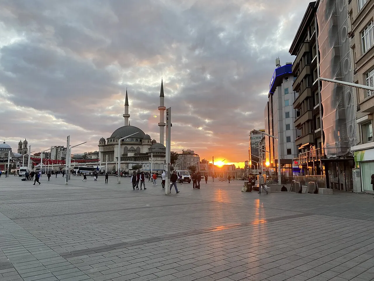
Taksim suits visitors who want upper Istiklal restaurants, theatres and the Ataturk Cultural Centre to feature in the evenings. Gezi Park and the Republic Monument give the square-side pocket its orientation. Cihangir adds cafe and residential streets down the slope, but an address there is not another station at Taksim's elevation. Choose between square-side access and the lower cafe setting rather than treating both as equally convenient.
M2 serves Taksim; F1 runs to Kabatas for the T1 waterfront connection. IST rail can use M11 to Gayrettepe then M2 to Taksim. SAW rail can use M4 to Ayrilik Cesmesi, Marmaray to Yenikapi then M2, with several changes rather than a direct metro arrival. Cihangir can add a steep final walk, and the entertainment setting differs markedly from Sultanahmet. Choose lower Karakoy if the tram and shore matter more or the historic peninsula if monuments dominate. F1 is the Taksim-Kabatas line, not Karakoy's historic F2 Tunel.
Plan it well: The square marker does not identify a Cihangir hotel approach.
GoTurkiye: Taksim Square and surroundingsBesiktas and Akaretler: European shore life without doorstep metro
Choose central Besiktas for coffee and breakfast streets, the Naval Museum, Akaretler and nearby Dolmabahce rather than for a broad district label. This is a European Bosphorus-shore stay with local ferry life, distinct from hilltop Beyoglu. Hotels farther inland towards Gayrettepe or Levent do not share the same waterfront setting, even though listings may place all of them within Besiktas.
The Besiktas ferry pier has a verified Kadikoy connection. Kabatas T1 and F1 are a different shore node, not a metro stop at Besiktas pier. From IST, M11 to Gayrettepe still leaves a checked road or bus leg to central Besiktas; from SAW, M4 to Kadikoy and the Besiktas ferry depends on the arrival-hour schedule. The drawback is less direct rail-to-hotel access than Taksim or Sirkeci, with shore traffic affecting the final road movement. Choose Taksim for stronger metro access or Kadikoy for Asian-side dining and SAW rail. Besiktas suits guests who will use the shore locally.
Plan it well: The marker identifies the Naval Museum near central Besiktas, not a whole-district centroid or ferry boarding gate.
Besiktas municipality: district history and landmarksKadikoy and Moda: Asian-side food streets and SAW rail
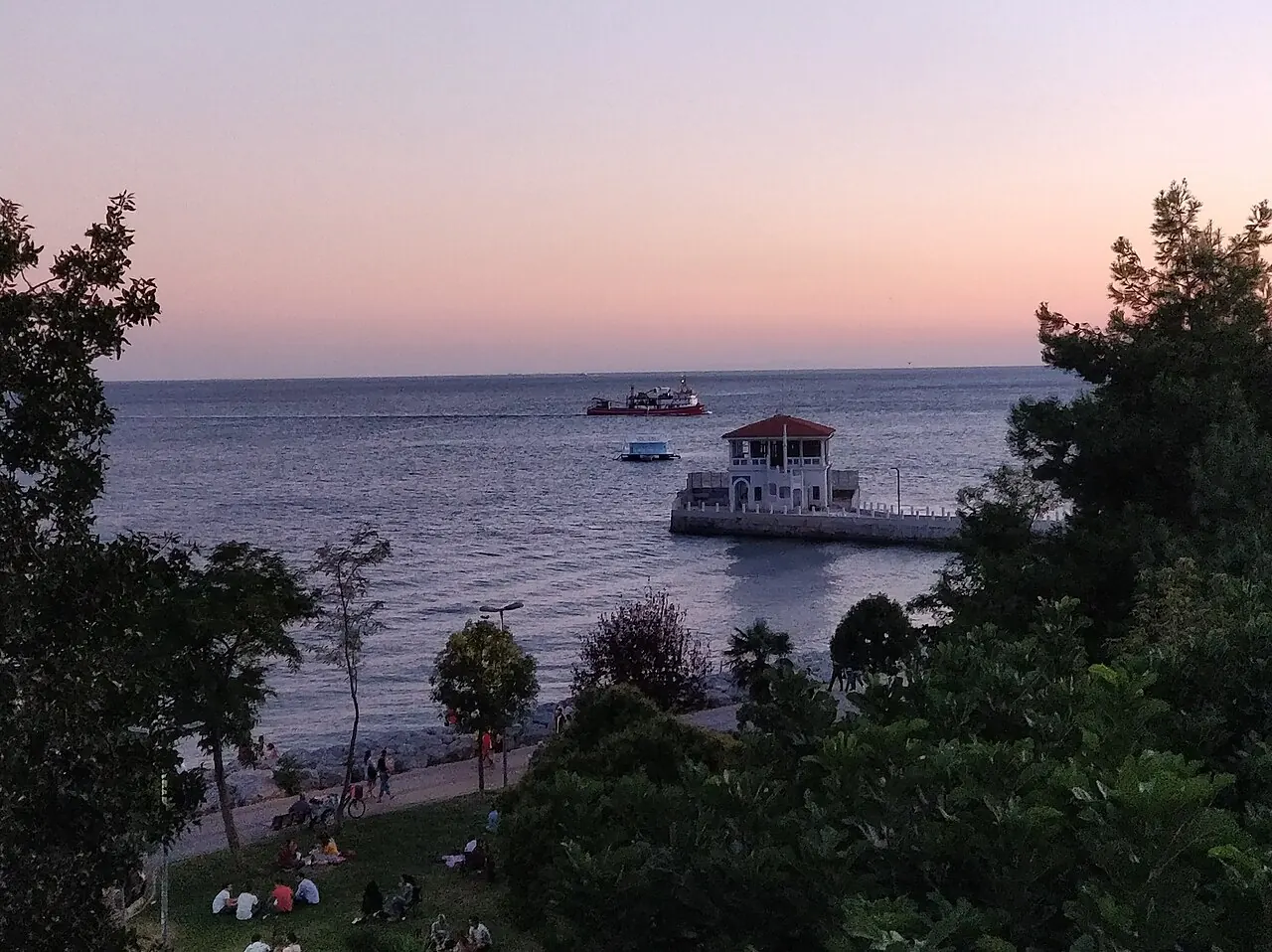
Kadikoy is a strong choice for a longer food-and-cafe stay on the Asian side. Market streets inland from the pier, Moda shore walks and Yeldegirmeni murals to the north provide different local outings. Moda gives a more shore-walk-led hotel pocket, while the metro-end market area better serves departures. Those advantages should be compared rather than applied equally to every Kadikoy address.
Metro Istanbul M4 links Kadikoy with Sabiha Gokcen Airport; Moda adds the actual local leg. Sehir Hatlari connects Kadikoy with Karakoy and Eminonu, and separately with Besiktas. IST rail is much less direct, combining M11, M2, Marmaray and M4 through Gayrettepe, Yenikapi and Ayrilik Cesmesi. The tradeoff is repeated crossings when European monuments dominate your visit, plus route-specific ferry departures. Choose Sultanahmet for a short historic-peninsula itinerary or Uskudar for an Asian shore base organised more around mosques and Marmaray. Kadikoy works best when its local evenings matter as much as the sights across the water.
Plan it well: The photograph shows Moda pier and promenade; the marker is the IDO Kadikoy terminal reference, not a Sehir Hatlari gate, M4 entrance or Moda centre.
GoTurkiye: Kadikoy neighbourhoodUskudar shore: historic mosques and rail crossings
Choose the central Uskudar shore for Mihrimah Sultan and Semsi Pasha mosques, the Balikcilar Carsisi fish-market streets and promenade views towards Maiden's Tower. The stay has a different local emphasis from Kadikoy's bar-and-cafe scene. Camlica is a separate inland outing, not another landmark outside the door of every waterfront hotel. Keep the comparison to the shore and station quarter rather than the whole large district.
Uskudar has Marmaray, M5 and a ferry pier. From SAW, use M4 to Ayrilik Cesmesi then Marmaray; from IST, M11 to Gayrettepe, M2 to Yenikapi and Marmaray gives a rail example. The Uskudar-Karakoy-Eminonu ferry is another route-specific crossing option. European sightseeing still requires the water or rail crossing, and an inland district address loses much of the station-side benefit. Choose Kadikoy for a food-and-evening-led Asian stay or Sirkeci for historic-peninsula access on the European side. Uskudar is strongest when you want these local shore walks rather than only somewhere to sleep before crossing back.
Plan it well: The marker identifies the Marmaray station, not a ferry gate or the boundaries of Uskudar.
GoTurkiye: Uskudar neighbourhoodPlan for the correct airport and shore
IST: M11 is not a direct train to every base
The current network map supports M11 to Gayrettepe and an M2 connection for Taksim or Sishane. Historic-peninsula and Asian-side hotels require further legs; central Besiktas still has a road-side approach.
Metro Istanbul: current network mapIST coach: use the actual Sultanahmet corridor stop
Havaist's resumed route names the IETT stop opposite Catladikapi Nikah Sarayi, Sirkeci and Sishane 6. The coastal Sultanahmet approach can leave a climb to the hotel. Verify the dated departure and stop against the live service.
Havaist: resumed Sultanahmet route and stopsSAW: M4 makes Kadikoy a distinct arrival choice
M4 connects Sabiha Gokcen with Kadikoy and Ayrilik Cesmesi. At Ayrilik Cesmesi, Marmaray supplies crossings towards Uskudar and Sirkeci; Moda or a European hilltop hotel needs an additional local leg.
Metro Istanbul: M4 routeChoose the ferry route, not just the destination district
Kadikoy-Karakoy-Eminonu is one named service. Besiktas and Uskudar use other timetables, and an IDO terminal marker does not identify a Sehir Hatlari departure gate.
Sehir Hatlari: Kadikoy-Karakoy-EminonuCheck the Uskudar crossing separately
The Uskudar-Karakoy-Eminonu timetable gives the actual ferry option for that shore. Do not assume every ferry route operates for a late airport arrival.
Sehir Hatlari: Uskudar-Karakoy-EminonuF1 and F2 solve different slopes
F1 connects Taksim with Kabatas; historic F2 connects Karakoy with Beyoglu. Neither removes every steep lane between the station and the hotel.
Metro Istanbul: F1 Taksim-KabatasBesiktas ferry access is route-specific
Use the Kadikoy-Besiktas schedule for the central Besiktas shore. Kabatas is a separate T1 and F1 arrival node, with an onward hotel approach.
Sehir Hatlari: Kadikoy-BesiktasCompare Istanbul hotels by bank, slope and useful stop
Browse Istanbul hotels around your chosen shore and actual transport node. Compare Sultanahmet square with its coastal approaches, Karakoy with upper Galata, central Besiktas with inland district addresses, and Kadikoy pier with Moda. Check room details and the last luggage leg before treating the neighbourhood label as enough.
Explore Istanbul hotels